- الصفحة الرئيسية /
- الرياضة الخارجية واللياقة البدنية /
- Hunting & Fishing /
- صيد السمك /
- أدوات /
- Charts & Maps /
- BA Chart 1607: England a East Coast, Thames E...

منتج #:
124546048
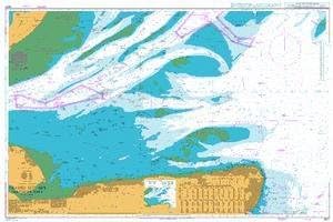
BA Chart 1607: England a East Coast, Thames Estuary, Southern Part
منتج #:
124546048
IQD 139038
Price Details
Excluding Shipping & Custom charges ( Shipping and custom charges will be calculated on checkout )
*All items will import from أمريكا
0 ratings
اكتب رأيك
متوفر فى المخزون
 مستورد من متجر USA
كمية:
اطلب الآن واحصل عليه حول الجمعة, يوليو 31
معاملة آمنة
تعمل يوباي جاهدة لحماية أمنك وخصوصيتك. يضمن نظام أمان الدفع المتقدم لدينا السرية من خلال تشفير معلوماتك أثناء النقل باستخدام بروتوكولات AES (معايير التشفير المتقدمة) وSSL (طبقة المنافذ الآمنة). تفاصيل الدفع الخاصة بك آمنة بنسبة %100 لأننا لا نشارك تفاصيل الدفع الخاصة بك مع بائعين تابعين لجهات خارجية
أفضل شركائنا اللوجستيين


تتوافق المخططات البحرية القياسية للأميرالية مع لوائح سلامة الحياة في البحر (SOLAS) وهي مثالية للاستخدام المهني والتجاري والترفيهي.

شحن
سريع

استرجاع
مجاني*

تغليف أمن

منتجات أصلية %100

PCI DSS Compliance

ISO 27001 Certified


Note: Step Down Voltage Transformer required for using electronics products of أمريكا store (110-120). Recommended power converters اشتري الآن.


مايفيد
تغطية شاملة
يوفر هذا المخطط البحري تغطية واسعة النطاق للساحل الشرقي لإنجلترا ومصب نهر التايمز، مما يضمن حصول الملاحين على المعلومات الأساسية للملاحة الآمنة والفعالة في هذه المياه المزدحمة.
معلومات مفصلة
بفضل التفاصيل الدقيقة حول الأعماق والمخاطر والمساعدات الملاحية، يعمل هذا الرسم البياني على تعزيز السلامة البحرية، مما يتيح للبحارة اتخاذ قرارات مستنيرة وتجنب المخاطر المحتملة أثناء الإبحار في المياه الساحلية.
مادة متينة
Printed on high-quality, water-resistant material, this chart is designed for longevity and durability, ensuring it withstands the rigors of marine environments, providing reliable guidance for seafarers over time.
تفاصيل المنتج
| وزن العنصر | 1.5 رطل (680 جرام) |
من يجب أن يشتري؟

-
الملاحون البحريون
Essential for navigators needing accurate maritime information for safe travels and navigation in the Thames Estuary.
-
عشاق الصيد
يوفر تفاصيل مهمة حول مناطق الصيد واللوائح التنظيمية، مما يفيد الصيادين الذين يتطلعون إلى استكشاف المنطقة.
-
شركات الشحن
تعتبر ذات قيمة كبيرة لشركات الشحن التي تتطلب خرائط موثوقة لنقل البضائع بكفاءة على طول الساحل الشرقي.

-
القوارب غير الرسمية
ليس مثاليًا لراكبي القوارب العاديين الذين قد لا يحتاجون إلى بيانات ملاحية مفصلة للرحلات الترفيهية القصيرة.
-
المسافرون البريون
غير مناسب للمسافرين براً، حيث يركز الرسم البياني فقط على الملاحة البحرية والطرق البحرية.
-
الحرفيين الترفيهيين في الهواء الطلق
قد لا يلبي احتياجات الحرفيين في الهواء الطلق الذين يبحثون عن معلومات شاملة عن المسارات أو الأنشطة البرية.
وصف المنتج
BA Chart 1607: England a East Coast, Thames Estuary, Southern Part
هل لديك أي استفسار؟ تحدث معنا
أسئلة وأجوبة العملاء
-
سؤال:
What is included in the BA Chart 1607?
إجابه: BA Chart 1607 includes detailed nautical information of the East Coast of England, particularly focusing on the Thames Estuary and its southern part. This chart provides crucial information such as depth contours, navigational aids, topographic features, and important landmarks. It ensures mariners have comprehensive guidelines for safe navigation, helping you identify hazards and navigate through congested waters effectively. Ideal for maritime professionals and enthusiasts alike, the chart also assists in planning routes and understanding tidal flows, ensuring informed decision-making on your journeys. -
سؤال:
Who is the primary user of the BA Chart 1607?
إجابه: The primary users of BA Chart 1607 are maritime professionals, including sailors, fishermen, and professional boat operators. Additionally, it serves as a valuable resource for sailing schools and maritime training centers. By providing crucial navigational data and topographic insights, it helps users navigate the complex waters of the Thames Estuary efficiently. Whether you're planning a local fishing trip or engaging in a large-scale maritime operation, this chart is essential for ensuring safe and effective navigation in these busy waters. -
سؤال:
Is the BA Chart 1607 suitable for recreational boating?
إجابه: Yes, BA Chart 1607 is highly suitable for recreational boating. It offers detailed information that aids in safe navigation along the East Coast, particularly for those cruising the Thames Estuary. Recreational boaters can benefit immensely from understanding water depths, tidal patterns, and potential hazards depicted on the chart. This ensures a more enjoyable and safe boating experience, whether you're sailing with family or friends, exploring coastal scenery, or engaging in water sports activities. -
سؤال:
How does the BA Chart 1607 differ from other nautical charts?
إجابه: BA Chart 1607 differs from other nautical charts by its specific focus on the Thames Estuary’s southern part, providing detailed local insights. Unlike broader maritime charts, this chart features meticulously plotted depths and navigational aids tailored for busy estuarine waters. The local detailing gives mariners a clearer understanding of this complex area, helping to avoid potential hazards. Moreover, it supports extensive marine activities such as fishing, yachting, and commercial shipping, making it a unique resource for navigating these waters. -
سؤال:
What kind of updates are available for BA Chart 1607?
إجابه: BA Chart 1607 is regularly updated to ensure it reflects the latest navigational information. Updates may include alterations in shipping lanes, modifications to buoy placements, changes in depth conditions, and newly reported hazards. Mariners can access these updates through the official BA website or related nautical publication platforms. Keeping your chart current is essential for maintaining safety and enhancing navigation accuracy, making it crucial for serious sailors and maritime operators to stay informed about these changes. -
سؤال:
Can the BA Chart 1607 be used for commercial purposes?
إجابه: Absolutely, BA Chart 1607 can be used for commercial purposes, making it a vital tool for shipping companies and freight operators. It provides precise navigational data necessary for commercial vessels navigating the busy waters of the Thames Estuary. The information aids in optimizing routes, ensuring that vessels can maneuver safely through crowded shipping lanes while adhering to maritime regulations. This makes the chart an essential resource for efficient and safe maritime operations in commercial shipping. -
سؤال:
Are there digital versions available for BA Chart 1607?
إجابه: Yes, there are digital versions available for BA Chart 1607, which can be utilized via navigation software or electronic charting systems. Digital charts offer enhanced features such as zooming capabilities, real-time updating, and easier integration with GPS systems, providing users with an engaging and interactive navigation experience. These digital formats are especially beneficial for tech-savvy mariners or those operating large fleets, enabling streamlined access to critical navigational data at their fingertips. -
سؤال:
What are the benefits of using the BA Chart 1607 for sailing training?
إجابه: Using BA Chart 1607 for sailing training offers numerous benefits, such as providing students with critical navigational skills in a practical setting. Instructors can utilize the chart to teach sailors how to interpret water depths, understand tidal influences, and identify local landmarks. The chart's detailed information equips trainees with the knowledge to make informed decisions during practice voyages, ensuring they are prepared for real-world sailing experiences. This grounding in practical navigation fosters confidence and skills that are invaluable in their future boating endeavors. -
سؤال:
Is there a physical or hardcopy version of BA Chart 1607 available?
إجابه: Yes, BA Chart 1607 is available in a physical format for those who prefer traditional charting methods. The hardcopy version offers durability and can be used in various maritime environments without the need for digital devices. This is particularly useful during outdoor activities where electronic systems might be less reliable. Mariners often carry both digital and physical charts to ensure they have all necessary resources for safe navigation, especially in coastal areas known for rapid changes. -
سؤال:
Where can I buy BA Chart 1607: England – East Coast, Thames Estuary, Southern Part?
إجابه: You can buy BA Chart 1607 at Ubuy, a trusted online marketplace known for a wide range of products including nautical charts. Ubuy provides a user-friendly shopping experience, ensuring that you can easily find, compare, and purchase this essential chart. With Ubuy, you are guaranteed access to a reliable source for all your nautical chart needs, making it a convenient option for maritime professionals and enthusiasts.
UKHO Charts & Maps مراجعة تحريرية
لم يتم العثور على مراجعات تحريرية
مراجعات العملاء وتقييماتهم
1 تقييمات العملاء
-
5 نجمة
100%
-
4 نجمة
0%
-
3 نجمة
0%
-
2 نجمة
0%
-
1 نجمة
0%
أضف تقييم لهذا المنتج
شارك أفكارك مع عملاء آخرين
منصة موثوقة وثقة كاملة للمشتري

MT
Mohd
مشتري موثّق
“The product received very good packaging & safe…Thank You”
16 June 2026 · عبر Trustpilot
SJ
Shawati
مشتري موثّق
“Accurate delivery timing given”
16 June 2026 · عبر Trustpilot
YB
Youcef
مشتري موثّق
“Not madly expensive like I thought, and much quicker than promised.”
15 June 2026 · عبر Trustpilot
LM
Leila
مشتري موثّق
“Never dealt with Ubuy before, but everything worked out great. Seamless cross border purchasing and shipping. Thanks!”
6/7/2026 · عبر Trustpilot
KA
Kwame
مشتري موثّق
“The process was smooth, with clear communication and timelines. This was my 1st purchase and I am really impressed. I will definitely be coming back.”
12 June 2026 · عبر Trustpilot
الخروج الآمن
شحن عالمي
إسترجاع سهل
منتجات أصلية
تاريخ سعر المنتج
معلومات مهمة
- القيود: بالنسبة للمنتجات التي يتم شحنها دولياً، يُرجى ملاحظة أن أي ضمان من الشركة المصنعة قد لا يكون صالحاً؛ قد لا تتوفر خيارات خدمة الشركة المصنعة؛ قد لا تكون أدلة المنتج والتعليمات وتحذيرات السلامة مكتوبة بلغة بلد المقصد؛ قد لا يتم تصميم المنتجات (والمواد المصاحبة لها) وفقاً لمعايير بلد الوجهة والمواصفات ومتطلبات الملصقات؛ وقد لا تتوافق المنتجات مع الجهد الكهربي المستخدم في بلد الوجهة والمعايير الكهربائية الأخرى (تتطلب استخدام محوّل كهربي أو جهاز تحويل إذا كان ذلك مناسباً). المستلم مسؤول عن ضمان إمكانية استيراد المنتج بشكل قانوني إلى بلد الوجهة. عند الطلب من يوباي أو الشركات التابعة لها، يكون المستلم هو المستورد المسجل ويجب أن يلتزم بجميع القوانين واللوائح الخاصة ببلد الوجهة.
- ليست كل المنتجات المدرجة على يوباي معروضة للبيع، لأن يوباي هو محرك بحث عالمي. المنتجات تخضع للوائح التصدير / التجارة.
IQD 139038
اطلب الآن واحصل عليه حول الجمعة, يوليو 31
هذا المنتج غير ممنوع في بلدي. (الرجاء الضغط على الرابط أعلاه إذا لم يكن هذا المنتج ممنوعاً في بلدك ، لذلك سيقوم فريقنا بمراجعته والسماح به.)
كمية:
معاملة آمنة
نوفر لك مدفوعات مشفّرة، وحماية متكاملة للمشتري، مع الالتزام بمعايير PCI DSS وشهادة ISO 27001:2022 لضمان أعلى مستويات الأمان في كل عملية شراء.
أفضل شركائنا اللوجستيين
أسرع توصيل عبر الحدود
المميزات والفوائد
- متوافق مع لواح سولاس للسلمية.
- مثالية للملاحة المهنية والتجارية والترفيهية.
- تتضمن مجموعة من المقاييس لمختلف الاحتياجات البحرية.
- يتم استكمالها بأدلة توجيه البحارة في الطرق البحرية المزدحمة.
- تم تصحيحها من قبل رسامي الخرائط المدربين بأحدث الإشعارات.
- تم إنتاجه من قبل أحد منتجي الخرائط البحرية الرائدين على مستوى العالم.
ضمان Ubuy
تسوّق بثقة مع منتجات أصلية %100، ومدفوعات آمنة متوافقة مع معيار PCI DSS، وحماية بيانات معتمدة وفق ISO 27001، وشحن دولي سريع، وإرجاع مجاني*، وتغليف آمن لكل طلب.